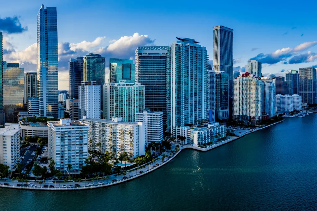
South Miami is a compact city of about 2.3 square miles of land in Miami-Dade County, and a home purchase here is shaped most by the Hometown District and its Metrorail station, county-run property taxes and flood rules, and the city’s septic-to-sewer conversion.
This guide walks through what the City of South Miami, Miami-Dade County, FEMA and the State of Florida publish that matters to a buyer or seller. Every rule and figure below is linked to the official source it came from.
What are the basic facts about South Miami?
South Miami is an incorporated city in Miami-Dade County, with its own commission and city manager, and a land area of roughly 2.27 square miles. The table below pulls the checkable basics from the city and the US Census Bureau.
| Item | Fact |
|---|---|
| County | Miami-Dade County |
| Town incorporated | March 2, 1926 (as the Town of South Miami) |
| City charter approved | June 24, 1927 |
| Population, 2020 Census | 12,026 |
| Housing units, 2020 Census | 5,297 |
| Land area, 2020 Census | 5,871,955 square meters, about 2.27 square miles |
| Government | Commission-manager: a mayor and four commissioners |
| Public school district | Miami-Dade County Public Schools |
| Rail transit | Metrorail, South Miami Station at US-1 and Sunset Drive |
The city’s own history page traces the city to a settlement named Larkins that grew up around a post office, with the Florida East Coast Railroad’s Miami-to-Homestead extension completed in 1906. It reports that the city shrank from about 6 square miles to just over 3 square miles in 1933. The city’s fiscal 2025 annual financial report adds that the University of Miami campus abuts the city’s eastern boundary along Red Road (SW 57th Avenue). The population and housing counts come from the Census Bureau’s 2020 place data.
What do the Hometown District and the park system add to daily life?
The Hometown District is the city’s central planning and placemaking area, and Sunset Drive is described by the city as its Main Street. According to the city’s Hometown District page, the district has existed since 1992, the city selected a design team in fall 2023, and work on branding, multimodal planning and Sunset Drive streetscape concepts began in early 2024. The district is described as undergoing ongoing redevelopment, so a buyer near it should read the city’s current plans before assuming how the streets will look in a few years.
Parking in the district’s public garages is paid, with a four-hour maximum, and overnight parking is allowed only at the South Miami parking garage with a digital overnight permit, according to the city’s Parking Division page.
The city’s Parks page says the park system includes 17 parks and facilities on 48 acres of parkland, with one outdoor pool, one splash pad, six playgrounds, a turf dog park and 12 athletic multipurpose fields among the listed facilities.
How do I get around South Miami without relying on a car?
Metrorail serves the city at the South Miami Station at US-1 and Sunset Drive, according to the city’s annual financial report. Miami-Dade County’s Metrorail page describes a 25-mile dual track that provides service to Miami International Airport, runs from Kendall through South Miami, Coral Gables and downtown Miami, and operates from 5 a.m. to midnight, seven days a week. The same page names Dadeland South as the southernmost station.
The city also lists MetroConnect SoMi, an on-demand rideshare service operated by Via that connects to transit hubs, with separate zones for the Dadeland stations and an extended South Miami zone.
What housing and neighborhood details does the city document?
The city publishes a Future Land Use Map and a Zoning Map, and those two maps, not a marketing description, decide what can be built or changed on a lot. Both are on the city’s City Maps page, along with an interactive GIS map for zoning, land use and infrastructure. The Planning and Zoning Division’s page says it handles variance requests, site plan reviews, sign permits and tree removal permits.
One named neighborhood on the city’s own record is Cambridge Lawns. The city’s financial report says its historic district holds about 30 homes in the Tudor Revival and Mediterranean Revival styles, completed in 1928 and given historic recognition by the city in 2005. When LPE Realty reviews a South Miami purchase near a recognized historic area, the first question we ask is whether the plan involves exterior changes, so the buyer can confirm with the city’s Planning and Zoning Division what review applies before anyone pulls a permit.
How are property taxes and the homestead exemption handled for a South Miami home?
A South Miami property owner pays the city, Miami-Dade County, the School Board, regional and other taxing bodies on one bill, and the city’s share is about one-fifth of the total. The city’s fiscal 2025 annual financial report lists these rates, in mills (one mill is one dollar per thousand dollars of taxable value).
| Taxing body | Millage, fiscal 2025 |
|---|---|
| City of South Miami | 3.9500 |
| Regional | 0.2571 |
| Miami-Dade County | 7.6688 |
| School Board | 6.6330 |
| Other | 0.4638 |
| Total | 18.9727 |
The same report says the county received 40.4 percent of the total tax bill, the School Board 35.0 percent and the city 20.8 percent. Rates are set each year, so the Property Appraiser’s Tax Visualizer is the place to see the current breakdown for a specific address. A purchase changes more than the rate: the Property Appraiser’s homestead page says an owner needs legal or equitable title and permanent residence as of January 1, and that applications and documents must be submitted by March 1. The county’s exemptions page describes the Save Our Homes cap as limiting annual increases to 3 percent for homesteaded property, and a buyer should not assume a seller’s capped value carries over. LPE Realty walks buyers through this in our homestead and Save Our Homes guide.
What should I know about flood risk and hurricane evacuation?
Flood risk in South Miami is decided parcel by parcel on the FEMA flood map, not by the city name. FEMA’s glossary calls the Special Flood Hazard Area the area where the mandatory purchase of flood insurance applies, and its flood zone page explains that shaded Zone X marks moderate hazard between the 1-percent and 0.2-percent annual chance limits while unshaded Zone X marks minimal hazard. The FEMA Flood Map Service Center lets you enter an address and pull the official map for it.
Florida also puts a disclosure duty on sellers. Under Section 689.302 of the Florida Statutes, a residential seller must give a flood disclosure at or before the time the sales contract is executed, stating whether the seller knows of flooding that damaged the property during ownership, whether a flood insurance claim was filed, and whether federal assistance for flood damage was received.
Miami-Dade County says evacuation orders are issued by zones or partial zones, and that its evacuation page links a Storm Surge Planning Zone finder and an Evacuation Orders map. The page calls evacuation centers a shelter of last resort. The city’s hurricane preparedness page notes that the Atlantic hurricane season runs from June 1 to November 30. Look up the exact address before signing, and read our guide to windstorm and flood insurance due diligence for the insurance side.
What do septic tanks, sewer plans and permits mean for a purchase?
Some South Miami homes are still on septic systems, and the city’s conversion plan currently focuses on a single project area. The city’s Septic-to-Sewer page says its master plan, adopted in 2016, divides the city into 11 project areas, A through K, that will eventually connect to the Miami-Dade County sewer system. Area K is the current focus, Phase II is scheduled for completion by the end of 2028, and the page says there are no funded projects or scheduled construction for Areas A through J. When LPE Realty reviews a South Miami purchase, we ask the seller in writing whether the home is on sewer or septic, and we flag which project area the address falls in.
For renovations, the city’s Permits and Inspections page states that forms submitted to the permit desk must be originals and be notarized, with two copies of any accompanying documents, and that an inspection requested before 3:45 pm is scheduled for the following business day. Tree removal permits run through Planning and Zoning.
How do I check the assigned public school for a South Miami address?
South Miami is served by Miami-Dade County Public Schools, and the assignment depends on the exact address. To see which school serves a specific home, contact the district through dadeschools.net with the full address and get the answer from the district, not from an advertisement, a neighbor or a map screenshot.
Frequently asked questions
Does South Miami have its own government separate from Miami-Dade County?
Yes. South Miami is an incorporated city with a commission-manager government made up of a mayor and four commissioners. Miami-Dade County still runs the Property Appraiser and the county tax rolls, and the county school district serves the city.
When is the homestead exemption application due?
The Miami-Dade Property Appraiser says applications and required documents must be submitted by March 1. You must also hold title and live in the home permanently as of January 1 of that year.
Is there a Metrorail station in South Miami?
Yes. The city’s annual financial report says Metrorail serves South Miami at the South Miami Station, at US-1 and Sunset Drive.
How do I find the assigned public school for a South Miami address?
Contact Miami-Dade County Public Schools through dadeschools.net with the exact address. Assignment depends on the address, so get the answer from the district rather than from an advertisement.
Do I need to ask whether a South Miami home is on septic?
Yes. The city’s septic-to-sewer plan covers 11 project areas, and its page says there are no funded projects or scheduled construction for Areas A through J. Confirm sewer or septic status in writing during due diligence.
Does Florida require a flood disclosure when selling a home?
Yes, for residential property. Section 689.302 of the Florida Statutes requires the seller to give a flood disclosure at or before the time the sales contract is executed.
Ready to take the next step in South Miami? Start with buy with LPE Realty or sell with LPE Realty. LPE Realty LLC is a licensed Florida real estate brokerage.